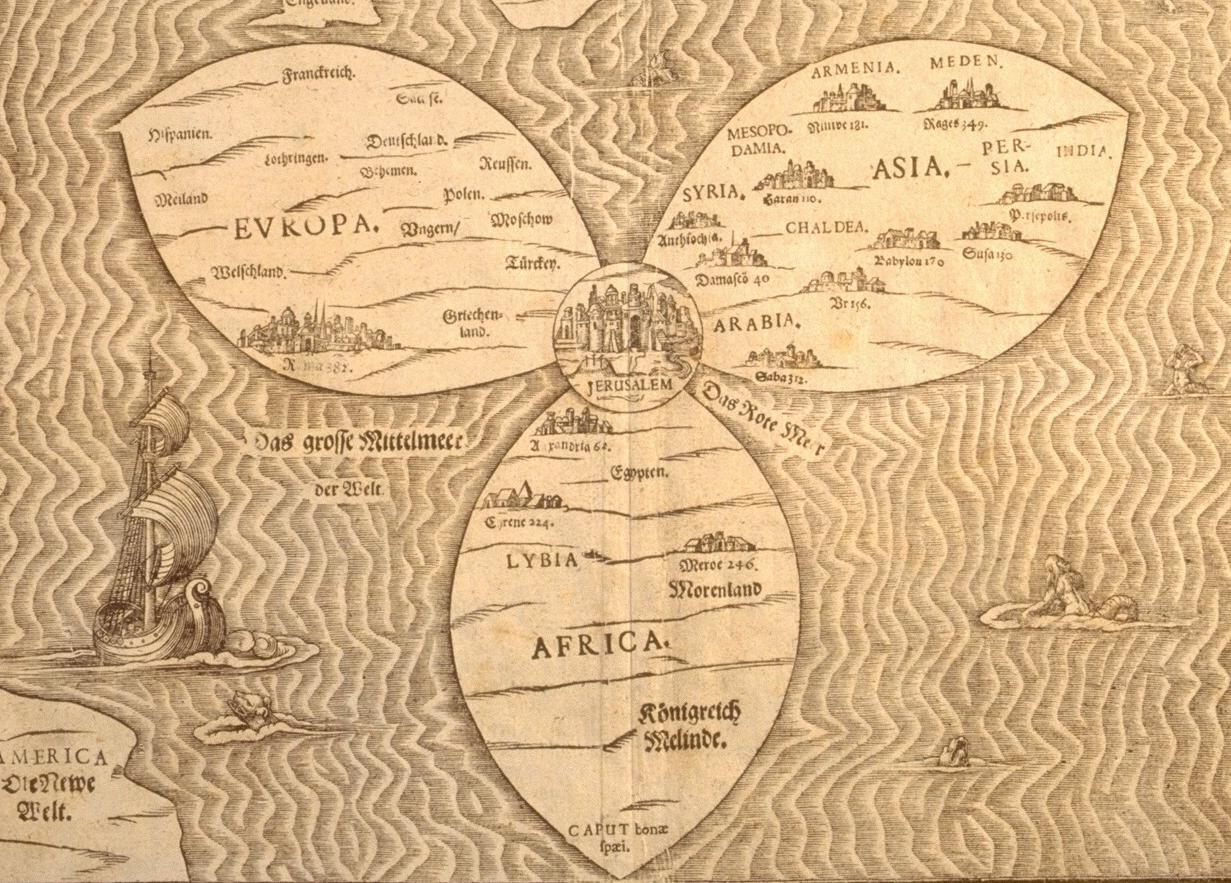
 Jerusalem World Map, Heinrich Bunting, 1581 (courtesy of the Osher Map Library)
For the last two weeks, we’ve been on a long road trip: from Connecticut to Ohio, Illinois, upstate Michigan, and back to CT. As journeys go, it was not perhaps as impressive as, say, Scott’s trek to the South Pole. He ate pemmican, we ate cheetos. He drove sledges, we drove an Odyssey. His party suffered from scurvy, ours sunburn. Yet we achieved our own kind of glory: 2600 miles, 50 hours in a minivan, with two adults, two children, and one toddler, aged 1.5. No one perished from strangulation or defenestration, none were committed to asylums, none have talked to the press. Victory is ours.
Yesterday, at the end of a particularly long leg, we found ourselves on Rte 80 in northern Ohio, looking for a meal that would please all and could be had fast. In other words, pizza. But where to look in the rolling cornfields of Ohio? We got off 80 and asked the toll booth attendant. She couldn’t think of any place that made pizza. What planet had we landed on? Michele and I consulted our road atlas, a misshapen, parchment-colored thing, to see if we could glean a site out of the black and red lines and place names.
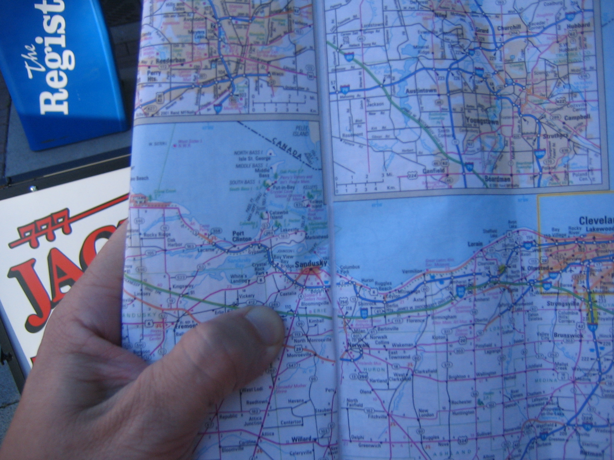
After some debate, we decided upon the town of Sandusky, about eight miles off of the highway from the exit. While it might have been possible to find pizza closer, it seemed unlikely to us that these small, silo-dotted towns would produce a pie to satisfy our elitist, bourgie palate. Without knowing anything else about the town of Sandusky, I liked the name, it sounded old, Polish perhaps? If so, I would imagine that it was settled in the early- or mid-19th century. Old Midwestern towns, I knew, were often built small and compact to accommodate walking traffic. These towns, with main street and thick brick commercial buildings, are now favorites of urban renovation, of ice cream shops, restaurants, and gourmet pizza. Sandusky, is this you? Moreover, the town was right on Lake Erie, at a point very close to the Canadian coast due north of the city. I saw them in my mind: hungry Canadian tourists climbing off the boat to celebrate summer at their favorite waterfront pizzeria.
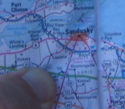
This was all a wild, sherlock-holmesian, stab in the dark. There was no evidence to back up this speculative conjuring from a 1996 Ohio road map. Yet in the end, we were right to head to Sandusky. It was indeed a place we imagined: an old city with downtown, sidewalks, old buildings, and waterfront. Local residents told me that it was struggling to become the renovated, gentrified place that sometimes take root in down-on-their-luck industrial towns. More importantly, we found our parlor, the “Mona Pizza” on the main street perpendicular to the waterfront.
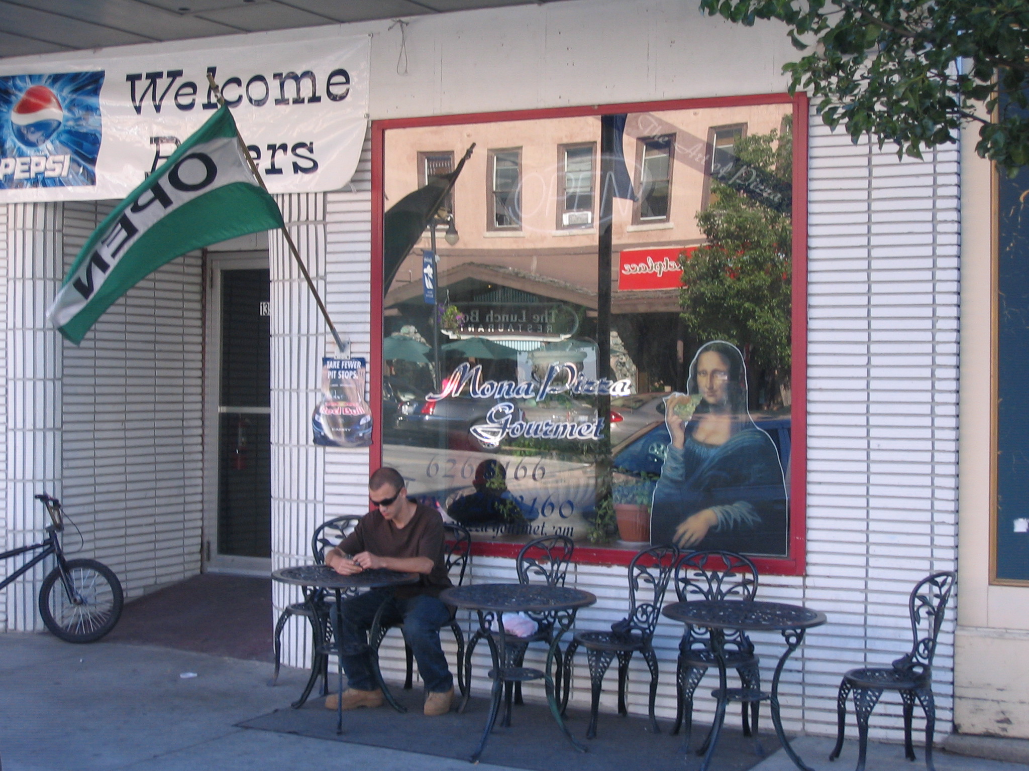
Mona Pizza, with its “Welcome Bikers!” sign, was was not quite the bourgie place I had imagined. But it counted where it mattered, offering up a tasty, New-York-style, thin-crust pie in 20 minutes.

All of this got me thinking about maps. Historians of many stripes are savvy in how they read visual documents, from pictures, paintings, and illustrations to maps. However precisely surveyed, however carefully rendered, maps and landscape are subjective documents, painted with the hues of culture as well as pigment. A long look at one of the landscapes of Frederic Church, for example, tells a great deal about Church’s vision of the country and of the United States as an emerging empire.
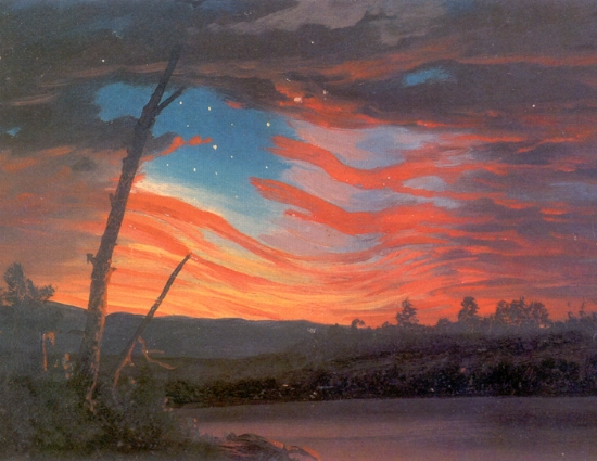
Frederic Church, “Our Banner in the Sky,” 1863
Yet it seems from what I’ve read (and from the visual analysis that I’ve done myself) that much of this analysis is focused on the object. That is, the question most commonly asked is “How do the historical artifacts carry culture?” Reading the road map of Ohio, I realized that many of our decisions had to do with our own cultural baggage as viewers, of our knowledge of Midwestern towns, our study of American history, our snooty notions of good pizza. Put more broadly, the Sandusky experience made me wonder how the individual subject encounters the map. How does the subject shape the map’s reading? This is a difficult question to answer. We all bring different things to our interpretation of maps, documents, indeed, virtually everything we come into contact with.
But it brought me back to issues of exploration.
For many academics, especially in the humanities, the world is a place divided into those-who-do (them) and those-who-interpret-what-others-do (us). Generally, relations tend to fall apart on the subject of “experience.” In the eyes of explorers, for example, historians can never fully understand events in the field because they weren’t there themselves. Historians, on the other hand, point to the importance of this distance from the field – of the biases that naturally result from close involvement in a project – in portraying events even-handedly. As one of the chronicler-class rather than the doer class, my sympathies have always been with my academic posse in this debate.
But reading the map of Sandusky, I realized the importance of the viewers’ perspective in reading the map. And in terms of my work, I realized the great gulf that separates the experience of explorers (both western and indigenous) from those of us who seek to figure them out. How, for example, did Robert Peary’s experience of the ice cap, or the Greenland ice sheet, shape the way he viewed such places inscribed on paper? How did James Cook’s knowledge of Atlantic currents shape the way he read his sketchy maps of the Pacific? Looking at these same maps, what did Cook’s Tahitian guide Omai see rendered there?


You should listen to Uncle Tupelo’s “Sandusky,” from their cd, “March 16-20, 1992.” You wouldn’t have had any trouble picking Sandusky, then.